 |
~ The Dempster Highway, CANADA ~
| |
|
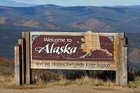
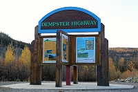
A Trip on the Dempster Highway |
|
|
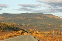
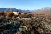
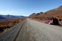
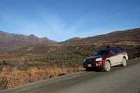
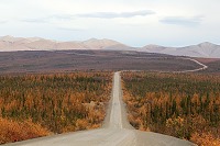
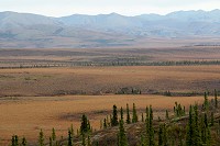
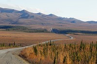
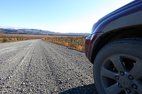
The Dempster Highway (Yukon Highway 5) is a 457 mile gravel road connecting the remote town of Inuvik to the Klondike Highway near Dawson City.
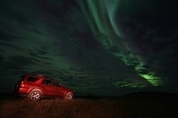
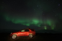
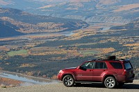
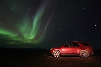
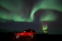
4Runner with Aurora
 |
|
|
|
|
|
|
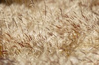
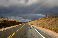
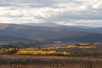
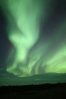
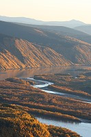
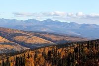
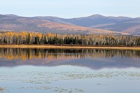
Driving this road is reminiscent of the Dalton Highway trip we did last year, also crossing the Arctic Circle
and taking us through some amazing sceneries, mountain ranges, expansive tundras, and pristine lakes. It is a long journey filled with great
photo opportunities during the day as well as during the night when the stars and the northern lights take center stage.
|
|
|
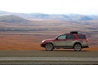
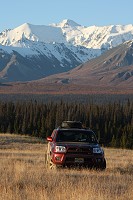
The Dempster Highway trip is actually just the first half of our expedition. The second half leads us to Whitehorse, the capital of Canada's Yukon Territory,
then back home to Alaska, a total of over 3500 miles for the whole trip. Fitted with Michelin Cross Terrain tires, our trusty Toyota 4Runner had one flat
while we were chasing the northern lights. No other issues to report.
|
|
|
|
|
On the Way to the Dempster: The Taylor Highway |
|
|
To get to the Dempster Highway from Tok, we follow the Taylor Highway. During the summer of 2010, some heavy rains severely damaged the Taylor Highway, but
fortunately, by September, most of the repairs were completed on our leg of the trip. The town of Eagle, however, is still totally cut off from the road
system at the time of our trip.
|
|
|
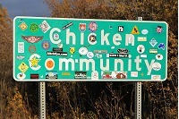
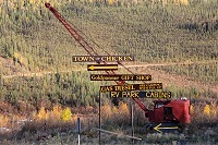
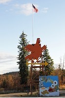
The town of Chicken is a tiny community of approximately 40 year-round residents located on the Taylor Highway. There is a small
gas station but there are no public utilities like power, sewer, telephone or internet. Generators and outhouses are the norm. The mere thought of
having to go to the bathroom in the middle of the winter is making me cringe.
|
|
|
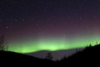
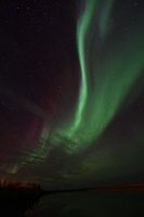
After a long day of driving, we spend the first night a few miles east of Chicken where we are greeted by some beautiful northern lights ...
|
|
|
|
|
|
|
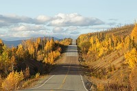
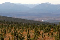
On the Way to the Dempster: Top of the World Highway |
|
|
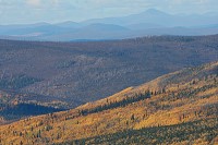
US Highway 5 (Taylor Highway) connects to US Highway 9, dubbed the "Top of the World Highway". Colorful foliage on rolling hills is a typical scenery
during the Fall in Alaska, and driving on an elevated highway affords us a commending view of the landscape.
|
|
|
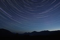
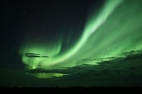
When the Night Sky Comes to Life |
|
|
|
|
|
|
On a trip like this, the avid adventurer is faced with a tough dilema: days are filled with long drives as well as great photo opportunities,
and during the night, the incredible northern lights keep us awake. Although there is little time for resting, we are more than
happy to be faced with this type of situation.
|
|
|
|
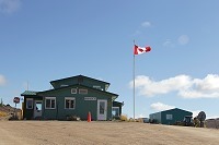
Border crossing on Highway 9 is only possible daily from 8 am to 8 pm (Alaska time), from mid-May to mid-September.
Beyond the small border outpost, we enter Canada's Yukon Territory and continue driving east on the Top of the World Highway.
|
|
|
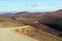
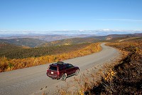
Driving Through the Yukon, on the Top of the World Highway |
|
|
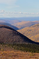
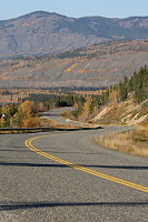
The road is paved on the Canadian side of the border, a welcome luxury after driving over bumpy gravel roads for the past few hundred miles.
As expected, there are more rolling hills and long winding roads ahead of us, as far as the eyes can see.
|
|
|
|
|
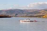
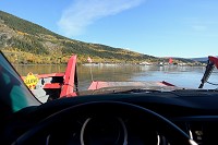
Ferry Across the Yukon River |
|
|
|
|
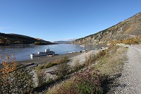
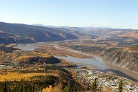
As we approach Dawson City, we get a glimpse of the Yukon River in a distance. There is no bridge over the mighty river, instead, a free ferry
service is provided. Fortunately, the wait time is negligible: we board the small ferry and reach Dawson City on the other side of the river,
a mere 2 to 3 minutes later.
|
|
|
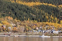
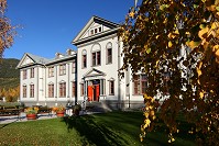
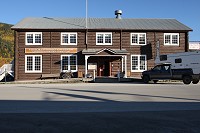
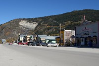
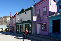
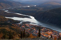
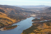
Dawson City is a small town of roughly 1500 residents nestled on the banks of the Yukon River.
Visiting Dawson City today takes you 100 years in the past, as it seems that the town hasn't changed much since it was founded in 1897.
You can still see historical buildings from the Klondike Gold Rush days.
|
|
|
|
|
|
|
|
|
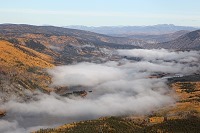
A short drive to the Midnight Dome lookout rewards us with an expansive view of Dawson City and the valley below.
|
|
|
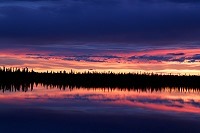
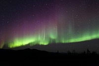
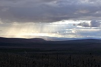
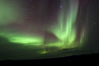
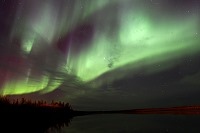
Night time in Canada's Yukon Territory is as colorful as the day time, except that nature is using a different palette.
As the sun disappears below the horizon, the warm fall foliage on the hills fades in the darkness while a backdrop of stars sets the stage
for the night show: the northern lights sweep high above our head and paint the sky in shades of red, yellow and green ...
|
|
|
|
|
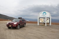
Milepost 0 - The Start of the Dempster Highway |
|
|
|
|
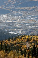
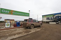
About 25 miles East of Dawson City, the Klondike River Lodge is strategically located at mile zero of the Dempster Highway. We make sure to top off
our gas tank, shuddering at the thought that the next gas station is 230 miles north at Eagle Plains. But then, the shuddering is quickly followed by a
pronounced tap on the forehead: the spot price for unleaded fuel is CAN $1.39 per litre (US $5.25 per gallon). What!?
|
|
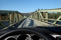
The Klondike River Lodge gas station is the last pit stop before the real adventure begins. Dare to cross the bridge and you are in the Yukon wilderness.
|
|
|
|
|
|
|
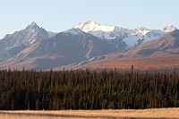
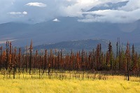
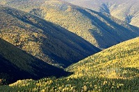
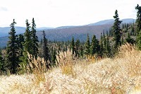
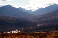
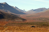
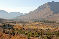
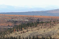
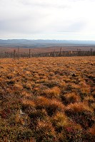
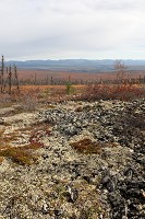
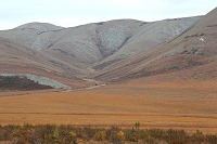
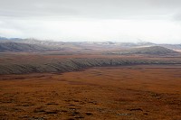
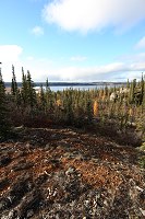
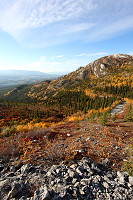
Milepost 47 - Tombstone Mountain |
|
|
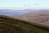
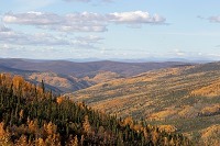
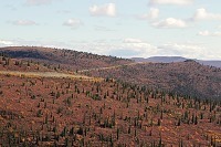
We follow the twists and turns of the Dempster Highway, enjoying a sunny blue sky. After driving through spruce and birch forrests of the
Klondike Valley for an hour and a half, the gravel road leads us to Tombstone Territorial Park where the landscape is more typical of a subarctic tundra.
|
|
|
|
|
|
|
|
|
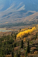
North Fork Pass
Elevation 4229 Feet
|
|
|
|
|
Tombstone Park,
South Side of the Pass
|
|
|
|
|
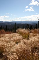
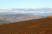
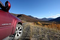
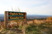
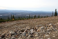
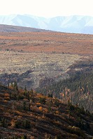
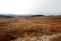
Milepost 161 - Ogilvie View Point |
|
|
|
|
|
|
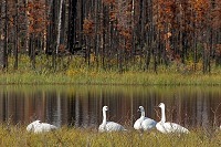
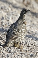
In the middle of this vaste unspoiled wilderness, it is surprising that we haven't seen much wildlife along the way. So far, we have only spotted
a lone caribou in Tombstone Park and a lone grouse near the Ogilvie ridge.
|
|
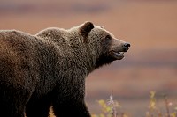
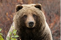
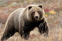
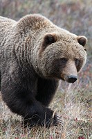
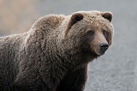
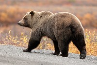
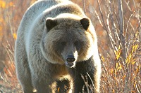
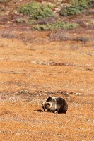
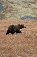
After several days on the Dempster Highway without any significant wildlife sighting, we finally spot several grizzly bears. This time of year,
bears are easy to spot on the tundra due to their massive size and dark fur. This big bear with an inquiring mind came really close to the truck.
|
|
|
Grizzly Bear on tundra
|
|
Close encounter
|
|
|
|
|
Long Bear Claws
|
|
Making eye contact
|
|
|
|
|
|
|
|
|
|
|
We see a total of 5 or 6 grizzly bears in the Yukon and
Northwest Territories.
|
|
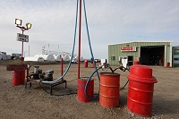
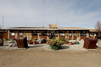
Milepost 230 - Eagle Plains |
|
|
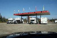
Eagle Plains marks the halfway point on the Dempster Highway. Open year round, this is a critical stop for road travellers as it is the first gas
station since the beginning of the highway, 230 miles ago. By now, I know the routine, and pulling up to the gas pump, I'm ready to brace myself for a sticker shock
and open the wallet very wide.
Due to the remoteness, I'm expecting to pay an exhorbitant price. Surprisingly, the spot price for unleaded fuel is CAN $1.39 per litre (US $5.25 per gallon),
which is the same price as the Klondike River Lodge. Ironically, I've never been happier paying US $5.25 per gallon.
|
|
|
Looking south
|
|
Looking north
|
|
There is also an RV campground at Eagle Plains, as well as a hotel which serves very good burgers, a real treat when you are so far away
from civilization.
|
|
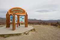
Milepost 252 - Arctic Circle |
|
|
With a full tank of gas, we are ready to continue our adventure north and reach an important but familiar milestone: the Arctic Circle. Last year,
we had crossed this same latitude on the Dalton Highway. So now, the challenge is on for next year! We need to cross
the Arctic Circle again, but from another road.
|
|
|
|
|
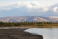
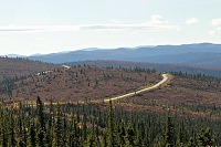
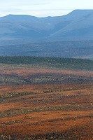
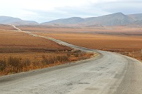
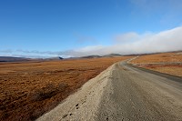
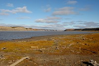
Milepost 289 - Yukon Northwest Territories Border |
|
|
Adjacent to Yukon's northern border is Canada's Northwest Territories where the arctic landscape is just as beautiful. We enter a new
time zone and set the clock one hour ahead.
Right: Road sign at Yukon border with Northwest Territories.
Below: The Dempster Highway twists and turns across the arctic tundra.
|
|
|
|
|
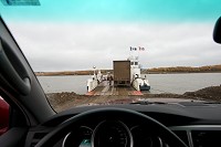
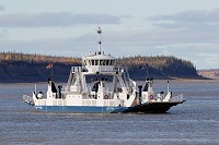
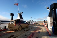
Milepost 335 - Peel River Ferry |
|
|
Another ferry awaits at the Peel river. This is the second of three ferry crossings required on the Dempster Highway.
The short ferry ride is free of charge but only operates from 9 am to about midnight and only during the summer and fall.
|
|
|
|
|
Milepost 342 - Fort McPherson |
|
|
|
|
When you're in the middle of nowhere, in the immensity of the Northwest Territories, it is a relief to see a gas station, no matter how
expensive it might be. I top off the fuel tank and can't help but tap my forehead again. Ouch!
|
|
|
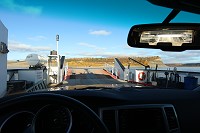
Milepost 378 - McKenzie River and Arctic Red Ferry |
|
|
The McKenzie River ferry is the third and last ferry crossing. The wait time is much longer here due to size of the river and also
because the ferry services 3 destinations instead of 2. The ride is also free of charge.
|
|
|
|
|
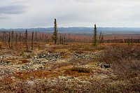
The final leg of the trip to Inuvik is a long boring stretch, driving through plains of black spruce. The landscape is
very flat with many ponds along the road. Seeing the Inuvik sign at the end of the Dempster Highway is a relief.
Being so far north above the Arctic Circle, the air is much colder, so
the thought of camping in the wilderness after a long day of driving is not very enticing. It would be good to spend the night in a warm hotel for a change.
The first hotel we try is CAN $195 per night but we eventually find some reasonably priced accommodations for CAN $99 per night.
|
|
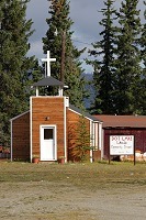
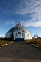
Our Lady of Victory
Church in Inuvik
|
|
|
|
|
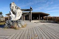
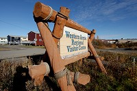
Inuvik visitor center
|
|
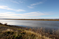
McKenzie River at Inuvik
|
|
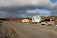
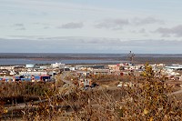
Home to 3600 residents, Inuvik is the northernmost Canadian town connected to the highway system. An ice road during the winter further extends
the road to the village of Tuktoyaktuk.
|
|
View of Inuvik
|
|
|
|
View from Jak Park
|
|
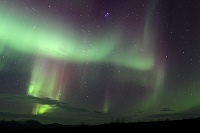
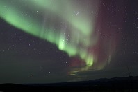
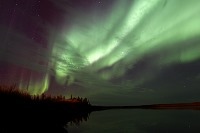
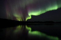
Another lucky night with clear skies brings us some great auroras in Inuvik. The northern lights are active with green and dark purple colors.
As expected, the night is quite cold.
|
|
|
|
|
|
|
|
|
|
From Inuvik, we head back south on the Dempster Highway. The next major destination is the city of Whitehorse, the capital of the Yukon, 758 miles away.
We will dedicate a whole photo diary page for the Whitehorse trip, but here is a preview with a few pictures for now.
|
|
|
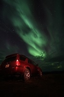
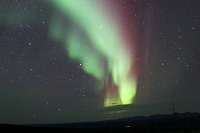
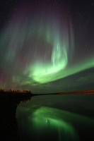
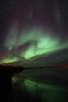
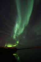
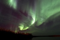
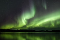
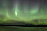
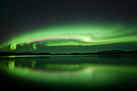
Whitehorse Northern Lights |
|
|
Again we have great luck with the northern lights on the way to Whitehorse.
To see more Aurora pictures, go to the Aurora page >>.
|
|
|
|
|
Go to the Moon & Get the Best Pictures
...Smile... ' Click! '

[email protected]
© Copyright Go2Moon, Alaska