 |
~ The Dalton Highway, ALASKA ~
| |
|
Dalton Highway - Introduction |
|
|
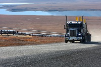
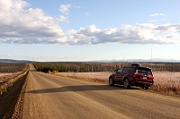
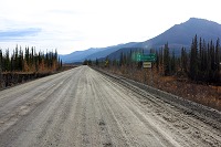
The James Dalton Highway, a 414 mile road connecting Deadhorse to the Elliot Highway near the town of Livengood,
located approximately 80 miles north of Fairbanks. Also known as the Haul Road, the Dalton Highway is critical to the delivery of
material, equipment and supplies to the Prudhoe Bay oil fields.
|
|
|
|
|
|
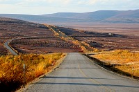
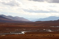
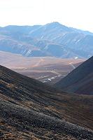
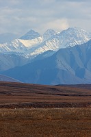
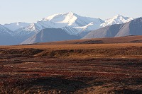
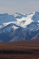
This is the road to the final frontier, crossing the Arctic Circle and continuing north past the 70th parallel, but ending just 10 miles shy of the Arctic Ocean.
Driving the Dalton Highway is a long journey taking you through some amazing sceneries, mountain ranges, expansive tundras, and pristine lakes.
In the middle of the Alaskan back country, the wildlife is diverse and abundant.
|
|
|
Starting from Fairbanks, you could reach Deadhorse in just one day after a grueling drive, however, you would miss out on the experience.
The avid outdoors explorers that we are, we decided to double the pleasure and allocated 2 days
to get to Deadhorse, and 2 days back to Fairbanks.
|
|
|
|
|
Safety is Key - Be Prepared |
|
|
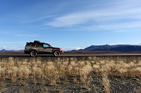
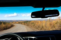
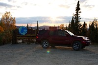
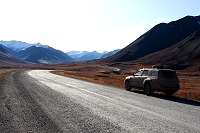
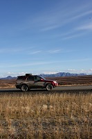
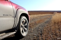
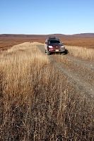
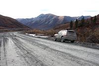
Although not very wide for a typical "highway", the roadway is large enough to accommodate commercial trucks. Most of the Dalton Highway
is gravel, with however, a few welcomed paved sections along the 400 miles. We encountered many smaller 2-wheel-drive sedans along the way,
but I would not feel safe and comfortable unless I drive a bigger 4x4 vehicle. The Toyota 4Runner is a very capable SUV for this type of expedition.
In addition to the huge potholes to avoid, there are many dangerous conditions that could compromise your safety:
- Numerous commercial trucks traveling at high speed, picking up dust clouds and gravels.
- Unpredictable wildlife on the roadway. Hitting a moose or a caribou can be fatal ...
- Flat tire(s). An extra spare tire is recommended. (see Coldfoot story).
- Running out of Gas? There are no gas stations between Coldfoot and Deadhorse, a 240 mile stretch.
- Night time driving increases your risks substantially.
- No service if you breakdown.
- No cell phone coverage.
|
|
|
Day One - Amazing Fall Colors |
|
|
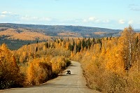
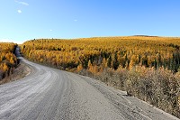
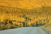
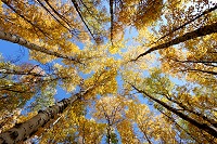
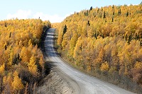
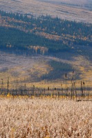
During the first few weeks of September, the landscape in interior Alaska transitions to a rich golden color as the trees turn yellow. The colors
are even brighter on this sunny day which marks the beginning of a promising trip. Leaving Fairbanks, the hills were all yellow as far as the eyes
could see.
|
|
|
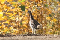
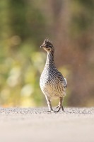
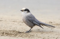
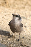
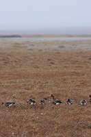
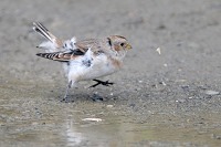
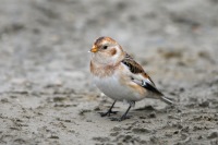
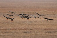
A flock of birds was spotted on the side of the road. At first, we thought they were Ptarmigans, but quickly realized we had never encountered
this type of bird before. They did not stay long, as a truck barreled down the road and scared them away ...
|
|
|
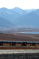
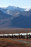
Still intrigued by this unknown bird, we continued our journey North. We later found out they were Sharp-tailed Grouse.
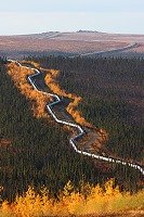
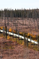
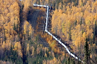
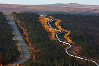
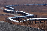
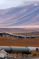
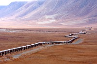
The Dalton Highway closely follows the route of the Trans Alaska Pipeline, operated by Alyeska, so there are many photo opportunities along the way.
The pipeline zigzags aimlessly across the landscape, as if the builders did not know which path to follow. In fact, this was intentional and
part of the seismic design: a straight pipeline would not be very resilient to lateral moves during earthquakes ...
|
|
|
|
|
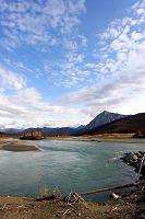
Milepost 56 - Yukon River Crossing |
|
|
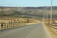
The Mighty Yukon ... In Athabaskan, Yukon means "Great River". We did not take many pictures here; we thought we'd take more on
the way back.
|
|
|
|
|
|
|
I heard there is a gas station immediately after the bridge, to the left, but we did not make a stop.
|
|
|
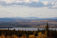
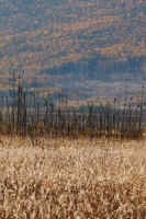
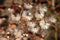
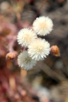
The landscape is changing as we drive further north, not only due to the change in vegetation, but the colors are transitioning from
bright yellow to pale pink for miles to come. The expansive Aspen forests slowly gave way to large fireweed fields. It's late in
the year so the flowers had already turned into fluffy seeds.
|
|
|
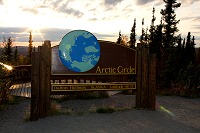
Milepost 115 - Arctic Circle |
|
|
We have reached a major milestone on our trip: the iconic Arctic Circle, an invisible line at the elegant latitude of 66�33'.
North of the Arctic Circle is the land of the midnight sun, where the sun never sets during the summer.
Dalton Highway Arctic Circle
|
|
|
So we are among the few lucky people in the world who can say they've been this far north.
|
|
|
|
|
|
|
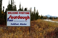
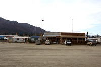
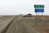
Coldfoot is a critical stop for the travelers of the Dalton Highway: this is the last gas station before Deadhorse, 240 miles away.
However, Land Rovers and BMW's beware, we did not see any Premium gasoline.
There are also some good hot meals to be had at the diner.
As we arrived at Coldfoot, we saw a father and daughter on the side of the road. They had a worried look on their face, so we stopped.
"What's wrong?" we asked. He said: "We had 2 flat tires about 1.5 hour north, so we had to hitch back to Coldfoot to have one of the tires patched up. We need
a ride back to the car." We first had to go fill up our truck and have dinner before we could continue our trip. About half an hour later, we went back
looking for them but apparently, they had managed to get a ride. Two spares are definitely needed on a trip like this.
|
|
|
|
|
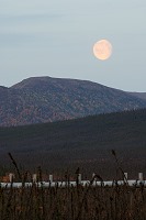
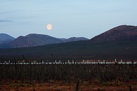
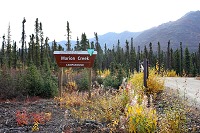
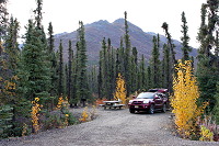
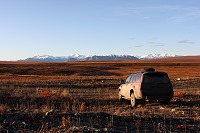
Milepost 180 - First Night in the Arctic - Marion Creek Campground |
|
|
Just 5 miles north of Coldfoot, we stumbled upon the Marion Creek Campground. We decided to inquire and take a quick tour of the area. It's actually a very nice
and well maintained campground with lots of trees which provided privacy. We though it would be a good spot to spend our first night above the
Arctic Circle ...
|
|
|
|
|
Camping spot with privacy
|
|
|
|
|
Behind our camp
|
|
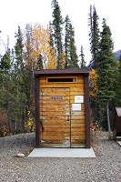
Arctic Bathroom
|
|
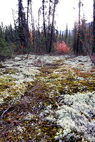
The following morning, I took pictures of the campground. After a good night of sleep, We are now ready to tackle Day 2.
|
|
|
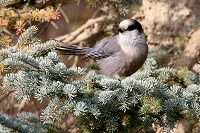
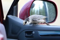
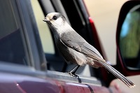
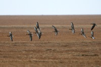
Just north of Wiseman, we saw a flock of birds flying low on the ground. These birds are not shy. In fact, as soon as we stopped, they swarmed the car.
They kept flying back and forth around us, and one of them even landed on my camera lens.
|
|
|
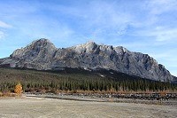
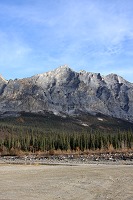
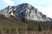
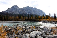
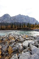
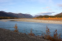
Milepost 204 - Sukakpak Mountain |
|
|
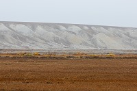
As we drove North, we came across a huge rock formation which stood out from the surrounding landscape, not only due to its size
but also because of the shape and texture. It did not look like a regular mountain but more like a "dinosaur tooth". Dalton Highway Sukakpak mountain
|
|
|
Dinosaur tooth looming over the Koyukuk River.
|
|
|
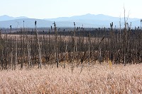
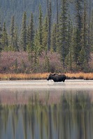
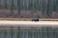
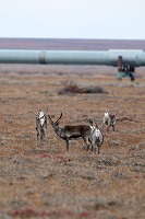
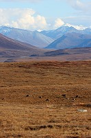
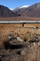
September in the Alaskan wilderness should be a great time to see big game like Moose or Caribou. To our dismay, we have driven over 200 miles
without seeing a single Moose. After several curses and complaints, we finally spotted one ...
It was a bull Moose grazing in a lake, unfortunately, it was
quite far. We wanted to hike along the lake shore to get a better view, but some fresh bear scat discouraged us from further exploring the area.
Dalton Highway Moose
|
|
|
|
|
|
|
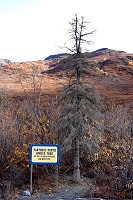
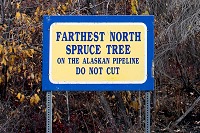
Milepost 235 - Farthest North Spruce Tree |
|
|
|
|
|
|
This is supposed to be the northernmost Spruce tree along the pipeline corridor. It does not look very healthy due to the adverse conditions.
I was tempted to plant a Spruce tree seed just 20 feet north of this one to see if it would grow.
|
|
|
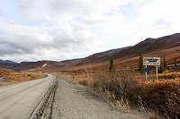
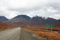
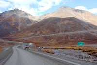
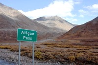
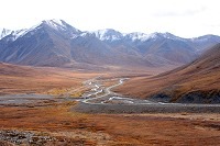
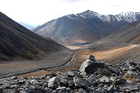
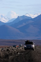
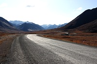
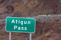
Milepost 244 - Atigun Pass |
|
|
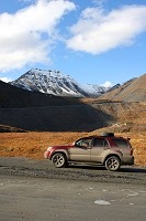
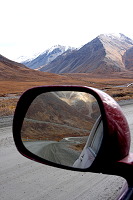
we are reaching a serious portion of the Dalton Highway: Atigun Pass is now less than 10 miles away. The elevation is slowly increasing for now but
the road will soon become much steeper as we reach the top of the pass at 4643 feet. The landscape has drastically changed to where the tundra has basically
taken over.
|
|
|
Entering North Slope Borough
|
|
Tundra
|
|
|
|
|
Atigun Pass, South Side
|
|
Atigun Pass, South Side
|
|
Climbing up the steep road
|
|
|
Looking south
|
|
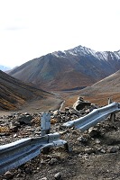
Real Danger
|
|
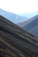
Mountain Slopes
|
|
Looking down valley
|
|
|
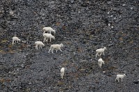
Mountain Goats
|
|
Atigun Pass, North Side
|
|
|
|
Taking a well deserved break after crossing the tallest pass in Alaska. We stop for a late lunch on the side of the road.
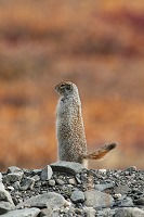
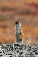
A Ground Squirrel pops its head from behind the embankment, and runs along side the road ... Dalton Highway Pipeline Photo
|
|
|
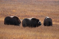
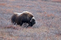
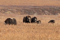
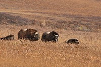
Milepost 300 to 340 - Musk Ox |
|
|
There are several herds of Musk Oxen near the Happy Valley area. The first herd can be seen near Pump Station 3. The weather is getting cold and misty, with rare
sun breaks. Heavier clouds, however, begin to form on the horizon to the North. We decide to press on to try to get closer to Deadhorse. Dalton Highway Muskox
|
|
|
Various Wildlife Along the Pipeline |
|
|
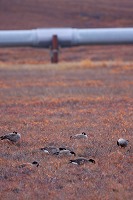
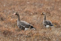
We are in the final 70 mile stretch to Deadhorse. The sun is about to set, and the weather conditions are worsening every mile.
The temperature has dropped considerably as the cold wind gains momentum. There's even freezing rain at times ...
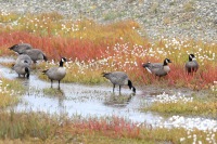
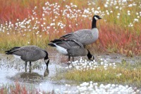
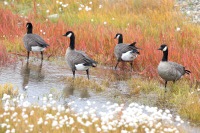
Yet, we stop for Canada Geese, Greater White-Fronted Geese, and Caribou along the pipeline corridor.
|
|
|
|
|
|
|
|
|
Is that guy carrying a
Caribou on his back?
|
|
|
The remaining 50 miles to Deadhorse are exhausting, more mentally than physically. I'm checking my gas tank gauge more often than I really need to, and
I can't believe I haven't gotten a flat tire yet, so I'm expecting the worst. Fortunately, the worst never came.
The landscape is barren, there is nothing for miles and miles, and it seems like it takes forever to reach our destination ...
When we finally arrived, we did not know that we were in Deadhorse: there is no sign, no "Welcome to Deadhorse", nothing that would give us
the relief and the assurance that "we had made it". Adding to the confusion, there is sign in town that reads "Happy Horse" rather than "Deadhorse".
|
|
"Happy Horse" Sign
in town
|
|
|
|
|
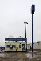
Gas Station
(No Premium)
|
|
|
|
|
|
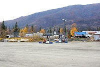
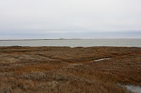
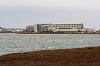
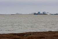
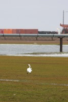
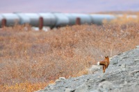
Deadhorse is a very industrial town. There are pipe racks, materials, heavy machinery and hardware just about everywhere.
|
|
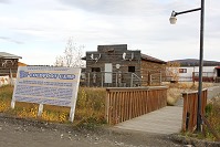
Wildlife in an Industrial World |
Surprisingly, we saw many Tundra Swans, Canada Geese, and even a Red Fox in this industrial landscape ...Dalton Highway wildlife
|
|
|
|
|
|
|
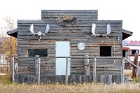
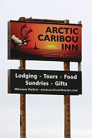
Second Night in the Arctic - Caribou Inn |
|
|
|
|
|
|
It is too cold and windy to be camping in the Arctic. A warm room in one of the local "hotels" is a welcomed break. Hotels here are
actually old mancamps recycled from the old pipeline construction days.
*** Update: The Caribou Inn is no longer in business ***Dalton Highway Hotel and Lodging
|
|
|
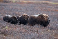
Day 3 - Migrating South to Warmer Climates |
|
|
It's been a tough 2 day trip to Deadhorse, but now we need to head back home. Day 3 is just as windy as the night before. No sense in spending too much
time in Deadhorse, so we fill up the gas tank and drive south. We're still looking for a "Welcome to Deadhorse" sign, in case we had missed it on
the way in. Nothing ... What's worse? We see this ominous road sign instead: "Next Services 240 Miles" - Sigh -
But, as we drive South, the weather seems to improve and so does the mood, especially when we see some wildlife.
|
|
|
|
Franklin Bluffs
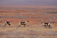
|
|
Small Caribou Herd
|
|
Dalton Highway Caribou
|
|
|
Greater White-Fronted Geese
|
|
|
|
|
|
Musk Ox
|
|
Dalton Highway Musk Ox
|
|
Photographing Musk Ox
|
|
|
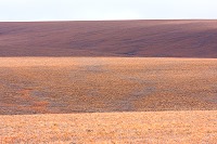
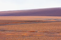
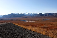
Wow... What a difference the sunlight makes! The same 70 grueling miles we were complaining about the day before are now turning into a pleasant
drive through an amazing landscape. When it was cloudy and rainy, we were not able to see the bright orange colors of the Tundra in the fall. But now, the sun rays
reveal a beautiful scenery where rolling hills display a contrast of light and shadows. Dalton Highway Tundra and Landscape
|
|
|
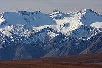
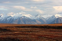
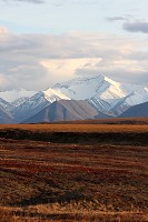
Another part of the Arctic back country we missed on the way in, due to the bad weather. On a clear day, the Brooks Range shows its splendor.
Dalton Highway through Brooks Range
|
|
|
Day 4 - A Day in the Arctic Wilderness |
|
|
On the third night, we follow a side trail and drive deep into the wilderness to find a suitable camping spot. I set up the cooking stove
so we can get a warm meal: Instant Noodles.
As the sun sets below the horizon, stars become visible in the night sky. Being far north of the Arctic Circle, we're hopeful we can see
some northern lights, so we try to remain awake. In the middle of nowhere, the night is eerily quiet. Suddenly, an unmistakable howling breaks the silence: it's
a wolf. We can only hear it ... we can't see it in the darkness. I keep checking for the northern lights several time through the night, but in vain.
The morning of day 4 is another sunny day. Dalton Highway Camping
|
|
|
|
Camping in the car
|
|
Waking up in the Brooks Range
|
|
|
|
|
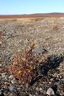
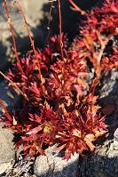
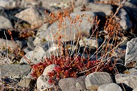
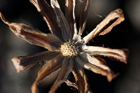
Wildflowers in the Brooks Range |
Dalton Highway Wildflowers
|
|
|
|
|
Lots of wildflowers can be found not far from the camp site even though the area looks arid and rocky. Being so late in the year, most of the
flowers were dried out.
|
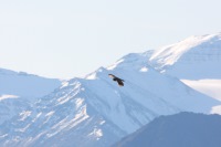
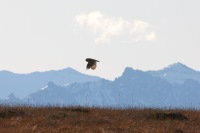
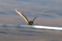
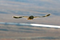
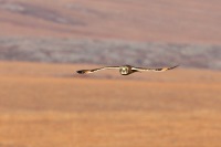
An Owl Catches Our Attention |
|
|
An Owl circles around us as we drive back to the main road.
Dalton Highway Owl
|
|
|
|
|
|
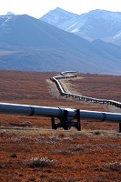
We're back on the Dalton, enjoying the drive. There are so many points of interest, however, it's getting late in the day
and we're still north of Atigun Pass. We press on ...
Dalton Highway Alyeska Pipeline
|
|
|
|
|
|
|
Atigun Pass appears in the distance. We're ready to tackle the Pass late in the afternoon, and fortunately, this is the last time we need to go over
the high peaks.
|
|
|
|
|
|
|
The worst is
Behind us now ...
|
|
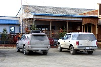
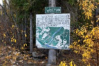
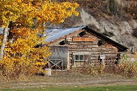
Milepost 189 - Visiting Wiseman |
|
|
On the way to Deadhorse, we did not get a chance to stop at Wiseman, so we take the opportunity to do so in the evening. We still have 55 miles
to go to reach Wiseman. At this point, our car is covered with a thick layer of mud. Along the way, we find a bear print on the ground,
with the pipeline in the background.
|
|
Dalton Highway at Wiseman
|
|
Bear print
|
|
|
|
|
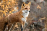
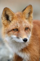
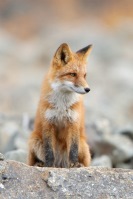
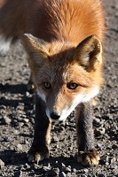
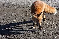
At the end of the day, miles away from Wiseman, a Red Fox peeks at us from behind a rock and crosses the road. Shy at first, it takes off
in an instant, but comes back later on to inquire.
Click to see more pictures of this Red Fox >>
|
|
Go to the Moon & Get the Best Pictures
...Smile... ' Click! '

[email protected]
© Copyright Go2Moon, Alaska